Logan Selley
GIS Specialist & Data Scientist
Transforming spatial data into actionable insights. Specialized in geographic analysis, web mapping, and data visualization using cutting-edge technologies.

Transforming spatial data into actionable insights. Specialized in geographic analysis, web mapping, and data visualization using cutting-edge technologies.
A comprehensive toolkit for spatial analysis and data science
Expert in geographic information systems with proficiency in both QGIS and Esri products for advanced spatial analysis and cartography.
Strong foundation in data science languages and web development technologies for building robust analytical applications.
Creating compelling visual narratives from complex datasets using industry-leading visualization tools and frameworks.
Developing interactive web-based mapping applications that make geographic data accessible and engaging.
Geography degree with Data Science concentration from University of Washington, complemented by Informatics and Music minors.
Passionate about humanistic geography, spatial problem-solving, and understanding the critical importance of location in human systems.
Showcasing spatial analysis and data science work

Collaborative project examining homeless populations' spatial access to voting centers in Los Angeles County, California.
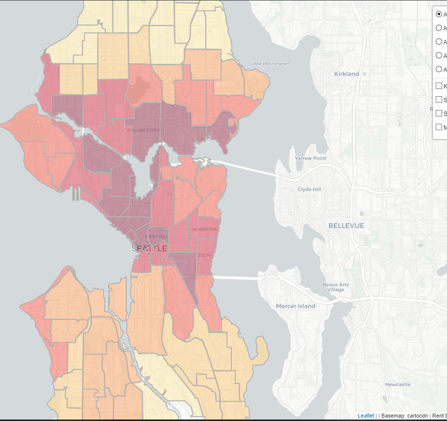
Interactive web map using Leaflet.js showing the distribution of rent costs in Seattle and their relationship to city zoning.
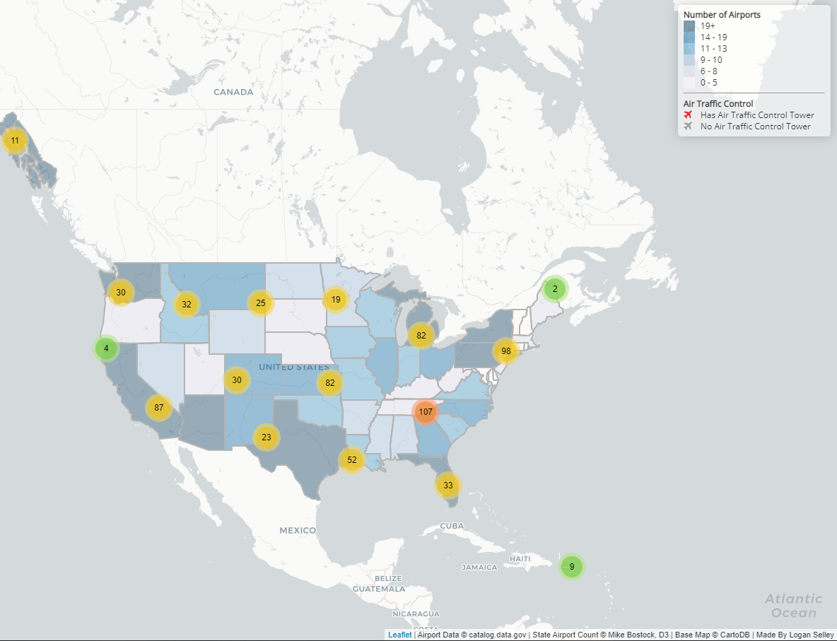
Clustered web map using Leaflet showing the distribution of airports across the United States.
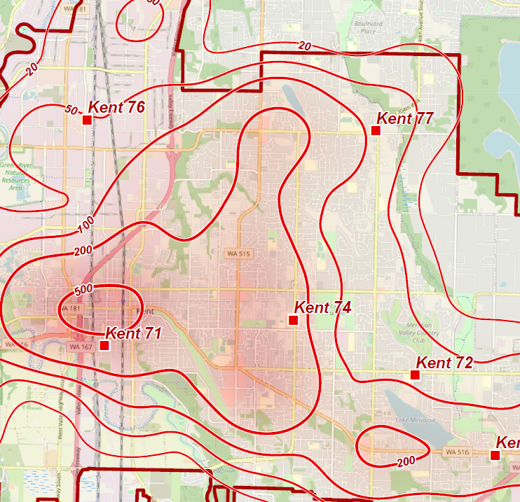
Analysis examining the concentration of emergency fire department responses in Kent, Washington.
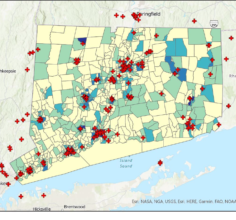
Press release-style analysis examining population access to federally qualified health centers in Connecticut.
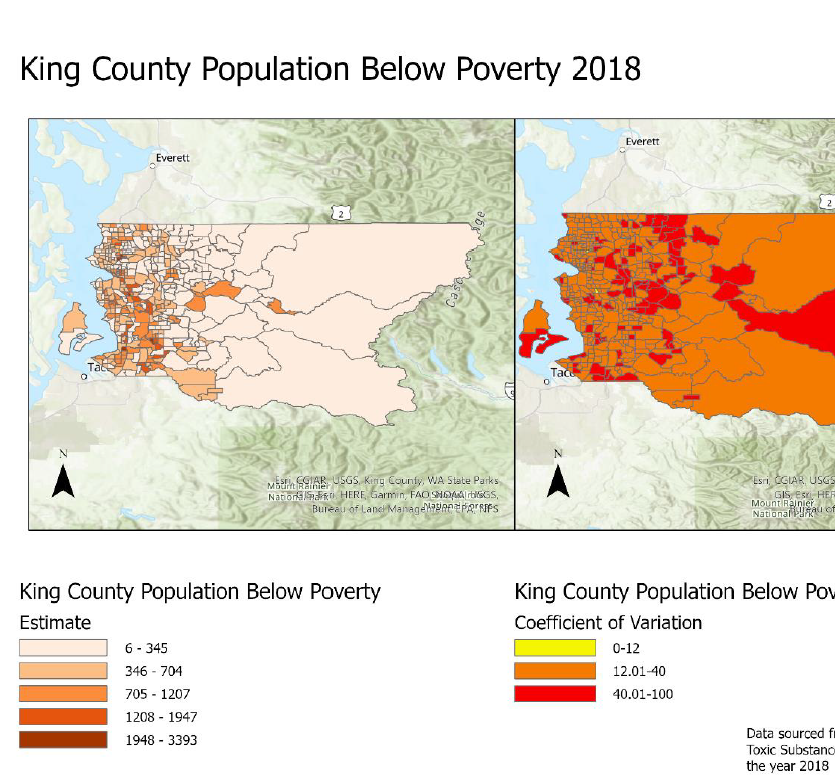
Comprehensive report examining the distribution of poverty in King County, Washington for 2018.

Data analysis examining mass shootings in relation to state happiness and gun legislation using R and Shiny.
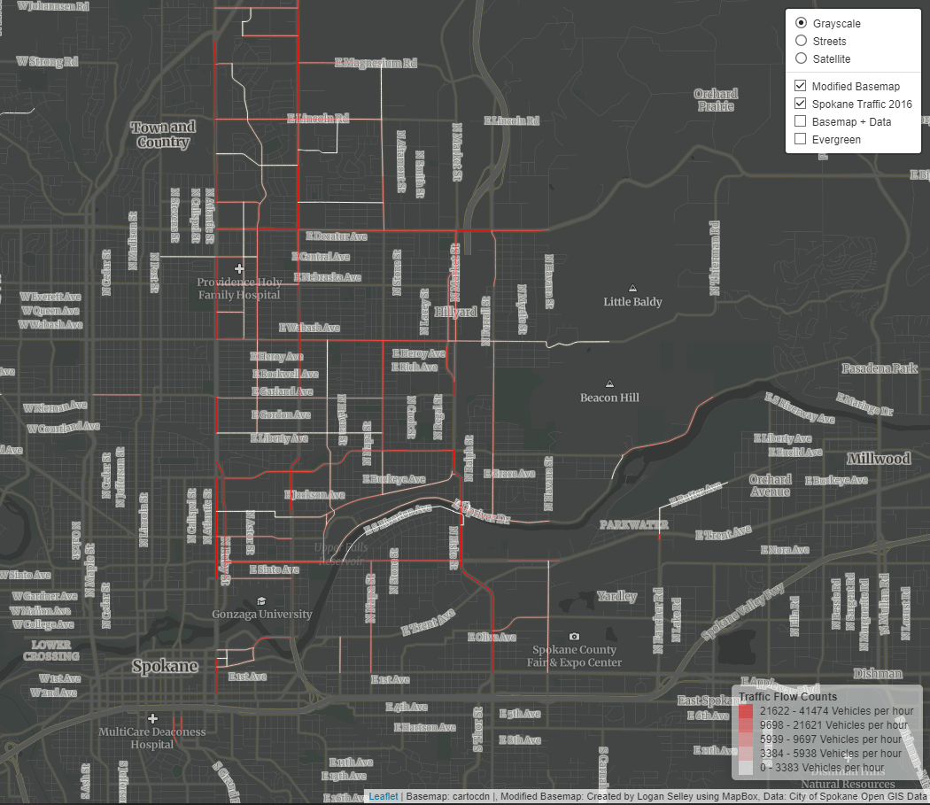
Leaflet web map exploring layer groups and custom basemaps showing Spokane traffic flow patterns.
Report applying and examining an educational opportunity index to King County, Washington.

Public Discord bot written in Python offering various functions for Discord servers, especially music playback.
Open to employment opportunities and collaboration